No information about the specific route of the troops of Alexander Yaroslavich is available, and eventually the versions suggested by historians eventually come down to three possible options. Most scholars believe that the Russian troops moved from Novgorod down the Volkhov towards Ladoga, where they were enhanced and proceeded to the site of the battle. Following this way, Alexander definitely would not miss the enemy. No reliable information about the enemy’s intentions was available, yet, judging by the previous invasions, the only way possible way for him was by water.
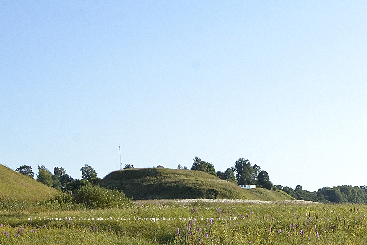
The second version of the itinerary of Alexander Nevsky troops — by land — was explained by A. N. Kirpichnikov. According to this scholar, the prince’s army marched from Novgorod to the Neva by road across Tyosovo settlement (about 150 km or two days’ quick march). The scholar believes that Ladoga warriors could have joined the Novgorodians on the way. Tyosovo is an old Russian settlement first mentioned in the chronicles in 1233–1234. It was destroyed by fire during the 1240 crusade of the Livonian Knights of the Sword against the Chudes and the Votes. Archaeologists have been able to locate Tyosovo fortress near the existing Zapolye village (Priozernaya volost, Luga district).

Tyosovo fortress
Now let us return to the itinerary of the Russian troops. P. Sorokin was convinced that the route should be reconstructed based on data from more recent sources and suggested his own approach to this problem. It becomes clear form these sources that the so called Orekhovets road existed in the 16th century and ran 50 km west of the Volkhov along its course. According to P. Sorokin, a bypass from Shapetsky post station in Shapki (85 versts from Novgorod) known from 17th century Swedish maps could have existed as early as in the 13th century. It passed the Yarvosol cemetery (Lezye area) and ended at the mouth of the Tosna river (about 30 km), just 10 km away from the Izhora. Most probably, the final leg of the route lay over limestone pavement from its intersection with the 16th century Orekhovets road towards the mid-course of the Izhora and further to its mouth.

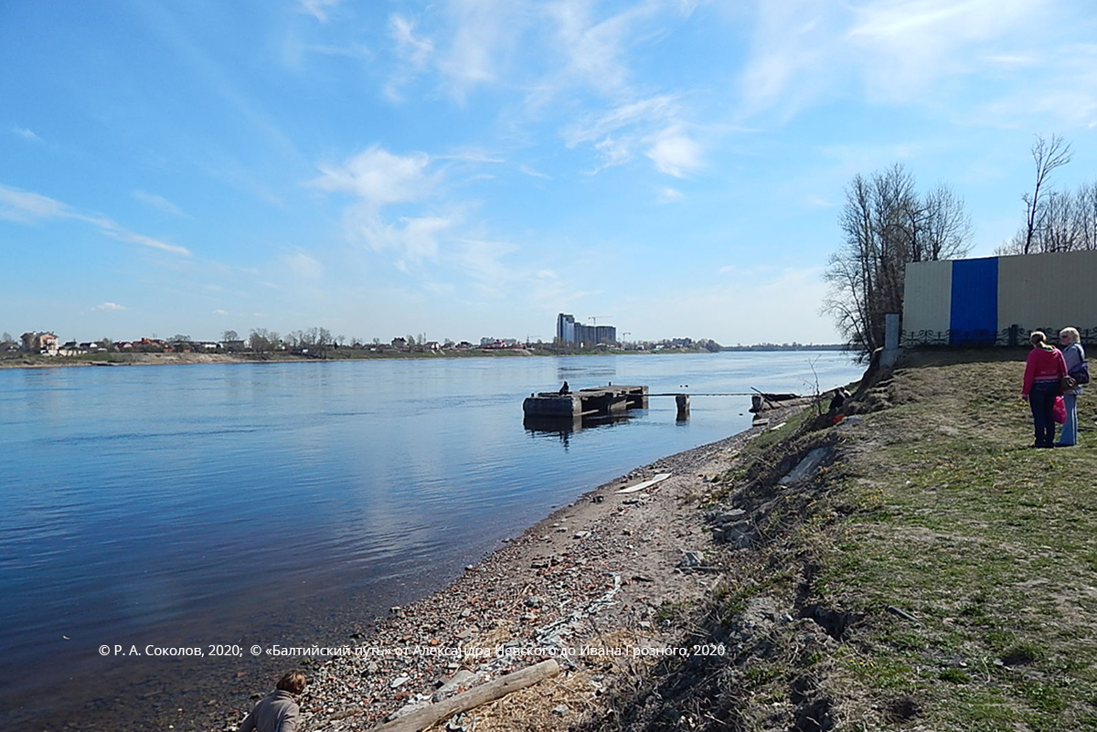
Ust-Izhora. View from the mouth of the Izhora upstream of the Neva River towards Tosna
The weak points of A. Kirpichnikov’s hypothesis and P. Sorokin’s scheme include two aspects. In the first place, at such a distance from the Volkhov Alexander would have lost control over the river that the Swedes used to proceed with their invasion. Secondly, the route was reconstructed on the basis of data from the 16–17th century sources, while no evidence of the actual existence of this road three hundred years earlier is available. Naturally, no settlements existed in the area of the future Shapetsky road and Yarvosolsky cemetery in the 13th century, as they do not appear in any sources before the end of the 15th century. The condition of Orekhovets road was rather poor in the 16th century. What could have been available by the mid-13th century? Neither Schlisselburg nor Korela fortress this route led to had been founded yet.
For this reason, the first option seems to be preferable. Most probably, Russian infantry moved down the Volkhov on vessels. Upon arrival at the mouth of the river, the army was enhanced with extra warriors from Ladoga and proceeded across Lake Ladoga and down the Neva rapids to the mouth of the Tosna. It may be assumed that the cavalry moved along river banks that in the 16th century were known as Ladozhskaya road (along the left bank of the Volkhov) and the road from Ladoga to Schlisselburg. At least the first mentioned of these land routes must have been in satisfactory condition in the 13th century, since communication between Novgorod and its northernmost and strategically very important «suburb» Ladoga was not only by water. At the final leg of the march the prince had to be especially careful in order to prevent detection of his army and maintain surprise as the key to success. On the other hand, it could not be ignored that the Swedes could start moving up the Neva at any time and should not have been missed, because this would have left the Novgorodian land unprotected. The prince’s solution of these tasks is described in section «Nevskaya bitva (Battle of the Neva)», and meanwhile the important role of the geographic factor — the Neva rapids in the rear of the Russian troops — should be emphasized. The Swedish fleet would need to spend an extra day on passing these rapids while moving up the river, which would give the Russians a chance to make the last leg of the march across woods without the risk of missing the enemy. Even if the Swedish fleet had been able to proceed towards Lake Ladoga, the Russians would have been able to catch up with them.
In accepting the «river» version of the march of the Russian troops, it is worth noting that the view of the course of the Neva is unobstructed for several kilometers from the mouth of the Tosna. For this reason, sailing along the Neva was undesirable due to the risk of detection. One of the solutions could consist in sailing up the Tosna and then marching to the mid-course of the Izhora. This route would totally preclude the risk of missing the Swedes, as Alexander would have been able to reach the enemy despite moving away from the Neva if the latter had started sailing up the Neva at that particular point in time. The Swedes still had to face a serious obstacle, i.e., the rapids (currently known as Ivanovskye rapids).

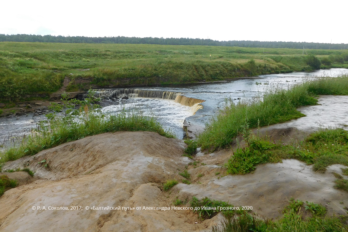
Rapids on the Tosna river
G. Karaev used the point of the closest proximity between the two rivers for reconstructing the route from the Tosna to the Izhora. Contrarily, N. Natalyin explored the local topography and found out that the direction suggested by N. Karaev (with the starting point 5 km away from the mouth of the Tosna) lay across a boggy area that would have been extremely difficult to wade through. On the other hand, in an upper section the river flows across limestone pavement that generates the rapids above the existing Nikolskoye town settlement. This section is wadable for cavalry. According to N. Natalyin, the Russian troops passed the raised limestone pavement avoiding bogs and reached the Izhora near the rapids that existed on this river in the 13th century in the area of the contemporary Yam-Izhora village.
This microregion was inhabited by the Ingrians that were allied to Novgorod. They lived in an area away from the Neva, covered by forests and bogs and adjacent to the mid-course of the Mga and the Tosna. Izhora people would support the Novgorodians that were approaching the hostile camp in the most covert manner.
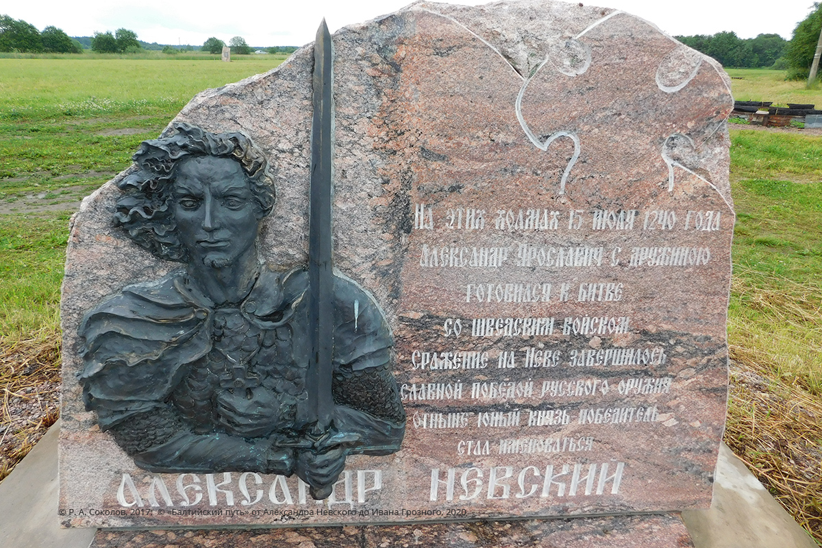
A memorial sign that initiated the creation of the historical and cultural heritage attraction «The site of the prayer of prince Alexander before the battle of the Neva» was inaugurated here in 2010 in commemoration of these events on the banks of the Tosna (in the estimated area of the 13th century rapids).

Memorial sign at the site of the last prayer of Alexander Nevsky before the Battle of the Neva (it is located between the village of Ulyanovsk and the city of Nikolskoye)
The way to this memorial supports the arguments of N. Natalyin, since the road along the left bank of the Neva connecting Saint Petersburg and Kirovsk runs across low woodland after Saperny settlement. Recently this area has become more developed as more infrastructure facilities have been built along the road, although this fact has not affected the overall impression of the low terrain. In hot summers the proximity of bogs that had been ignored by G. Karaev is indicated by permanent smoky mist generated by peat fires. Once in Otradnoye, cross the Tosna, turn off the road onto Nikolskoye and then onto the road to Ulyanovka. The memorial sign on the site of the prayer of Alexander Nevsky before the battle of the Neva is located on the right bank of the Tosna between Ulyanovka and Nikolskoye, not far from the bridge of the road to Ulyanovka. You will note that the dry elevated and hilly terrain would have been much more convenient for Alexander’s troops heading for the Izhora compared to a route lying closer to the Neva.
To draw the bottom line, today you can cover an itinerary that is very similar to that of the Russian troops back in 1240 literally in a day. Take route 10 «Russia» in Novgorod. In Zuevo turn off onto Kirishi and move along the Volkhov. Make a stop in Staraya Ladoga to explore the surviving pre-Mongolian churches of Leningrad Oblast. As legend has it, Alexander Nevsky prayed ardently in one of them, namely St. George’s church, on his way to the Neva in 1240. Another local tradition relates the foundation of Nikolsky monastery in Staraya Ladoga and construction of a stone church in it with the prince’s desire to thank God for the victory won on 15 July 1240.
Driving from Staraya Ladoga to Saint Petersburg along R-21 «Kola», you will be able to see the limestone pavement (extended highland that had once been the shore of the Littorina sea) in open areas. This limestone pavement reaches the southern shore of the Gulf of Finland and lies under several river courses with lithic rapids. While enjoying the landscape, do not forget to turn off onto Kirovsk before Ladozhsky bridge across the Neva and proceed to Ust-Izhora along the left bank of the Neva across its left-bank tributaries, i.e., the Mga, the Svyataya (the Svyatka) and the Tosna.
Tags: routes, Battles, 13 century, Following Alexander Yaroslavich: the Battle of the Neva, the Battle of the Neva, North-West Russia, Novgorodian Land

 English (United Kingdom)
  Russian (Russia)


